 |
| Khao Nam Khang National Park |
 |
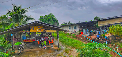
| The rain teetered off to a drizzle at about 7 am, enough time for us to walk out to Route 4 for hot food @ https://maps.app.goo.gl/5rP89okjJYm1ku4E7 |
 |
| Pork kueh tiau soup |
 |
| Khao tum was excellent |
 |
| It was still raining after we finished breakfast. The only difference was how heavy the rain was. Sometimes it was a light drizzle, sometimes it was raining hard. The saving grace was there was no thunder and lightnings. Thus at 9 am, we decided to set out from our hotel. Photographed here at 9.30 am is a rural road halfway to Wat Huai Khu temple @ https://maps.app.goo.gl/CYoESqJtU3YE525T8 |
 |
| Within the same minute the earlier gravel section was photographed, we hit concrete again! Overall gravel and dirt spanned less than 1km. Most of the rural road are in concrete @ https://maps.app.goo.gl/nUzdGqcR5m7EEhSN9 |
 |
| Compact gravel @ https://maps.app.goo.gl/GuwwmzapHXDgixtv8 |
 |
| Probably the worst section of the rural road @ https://maps.app.goo.gl/iuJUJ5cHSjbxazCK6 |
 |
| Buddhist temple @ https://maps.app.goo.gl/d9zPtTnzEq666d8Q8. There was no caretaker here when we arrived so we searched and found a dilapidated toilet which served us well enough |
 |
| The temple featured a monk... |
 |
| ...and snakes |
 |
| At the junction to rural Road 3023, back view of the road we had just travelled in @ https://maps.app.goo.gl/uKnbDNo8MjrzTxr8A |
 |
| Looking at Rural Road 3023 @ https://maps.app.goo.gl/rm8NzLRTJBigTzYM8 |
 |
| Turned off from Rural Road 3023, heading towards Wat Huai Khu @ https://maps.app.goo.gl/xEXsRJNcNVfSCAta8 |
 |
| Wat Huay Khu @ https://maps.app.goo.gl/N2ED64jzEnb72nvs6 |
 |
| At 10.20 pm, we found our first eatery! Delicious Thai Fried Koay Tiau |
 |
| The Chef |
 |
| The Eatery |
 |
| The Location @ https://maps.app.goo.gl/tGZD6cQFGPEPdQaLA |
 |
| Can you spot the missing bicycle? @ https://maps.app.goo.gl/4wzisokPQPiNS8m9A |
 |
| Route 4243 |
 |
| Some government building which is not manned. This marks the start of the climb |
 |
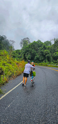
| The climb to the peak spanned 1.5 km with a grade hill of 11% |
 |
| The start of the climb @ https://maps.app.goo.gl/jsCt9Xs7pJF2qGBs9 |
 |
| It's hard to climb with a 50t chainring |
 |
| We were so far apart! |
 |
| Mists blowing in |
 |
| Almost at the peak @ 287 m |
 |
| Ton Lad Waterfall @ 12 pm |
 |
| Route 4243 cuts through the National Park |
 |
| We had a tea break here |
 |
| We did not trek in to see the waterfalls but the river by the picnic area was majestic enough |
 |
| Back on the road heading to Thung Kha |
 |
| Rear view |
 |
| Delicious lunch at 12.50 pm, near Wat Na Prang Pracharam @ https://maps.app.goo.gl/brxeCvVzHJKzRomH6. We also bought pisang goreng from a nearby stall |
 |
| We finally reached Mee Sa Neh Resort at 2 pm |
 |
| The owner's house in green. On the right is an event hall where the owner's family had their dinner and watched TV. The entrance opens up to the road which leads to Route 4113 @ https://maps.app.goo.gl/vqDwr1yWRGYiriRs6. There's a stall just opposite the entrance where we ordered our dinner to be delivered to the resort |
 |
| We preferred to dine here by the dining table than in our room. There's sachets of tea and coffee which we could help ourselves to |
 |
| From the entrance, we passed the owner's unit and hall, turned right at this concrete road to get to our unit |
 |
| Actually, our unit is right next to the "dining area" separated by the partition visible in this photo! Shortcut! |
 |
| The unit next to us, separated by the concrete road |
 |
| The units opposite us. Turn right at the end to reach the entrance |
 |
| Typical Thai bed on concrete slab |
 |
| They even have a sofa |
 |
| Junior's corner |


No comments:
Post a Comment