Championship No 4 - Bukit Berapit Rail Tunnel and Bridge
 |
| Bukit Berapit Rail Tunnel |
 |
| Bukit Berapit Rail Bridge |
 |
| We started from Taiping after breakfast and took A109's Jalan Air Kuning. Pictured here is Jalan Mat Kassim @ https://maps.app.goo.gl/GWU4wEBgpbYjAW4K7 |
 |
| The bridge leading to LT D' Chalet @ https://maps.app.goo.gl/QoXpakyCrdjhYQj97 |
 |
| The chalet in the background |
 |
| LT D' Chalet @ https://maps.app.goo.gl/LAfKfJ8zHnBN5KHEA |
 |
| You can see the new electrified double tracking railway line from here |
 |
| Going under the new electrified double tracking railway bridge |
 |
| Going under the new electrified double tracking railway bridge |
 |
| Almost immediately after going under the new railway bridge, we spotted the old railway line. However, the railway tracks have since been removed. |
 |
| Initially, the old line runs parallel to the stream below @ https://maps.app.goo.gl/xC3tNVP8rMw8WT3k7 |
 |
| Soon we lost sight of the stream and began a gentle climb to the tunnel and bridge |
 |
| As we are cycling on a former railway tracks, the path is strewn with gravel |
 |
| Bumpy ride on a Brompton |
 |
| About 500m from LT D' Chalet, we reached the old railway tunnel @ https://maps.app.goo.gl/xUx7S4C348ktbWhg7 |
 |
| The tunnel is about 500m in length and quite straight, hence you can see from one end to the other. |
 |
| This is NOT a selfie! You can see the team reflected in the sunglasses |
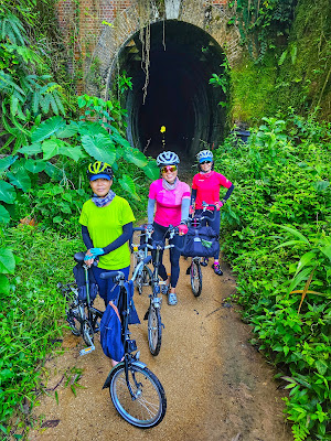 |
| Girls Power |
 |
| The tunnel opening is laid with red bricks... |
 |
| ...deeper in, it is just raw rocks! |
 |
| Strangely, we spotted a fish inside the tunnel... |
 |
| ...and some freshwater prawns... |
 |
| ...even bats!!! |
 |
| At this point, we were praying hard they don't defecate on us! |
 |
| Light at the end of the tunnel |
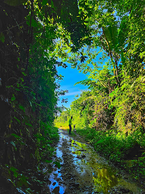 |
| Outside again |
 |
| The other opening end is also fortified with red bricks. The original railway tracks were said to be removed in 2017 |
 |
| This was part of the MMTF route in 2022, an ultramarathon with a 100 km distance @ https://maps.app.goo.gl/ZHk69iFYLXTpYYKa7 |
 |
| The trail was somewhat overgrown in certain areas @ https://maps.app.goo.gl/TBac6b5iqfWgv3TCA |
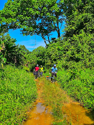 |
| Boy, were we relieved to find a credible path... |
 |
| ...even though it was water logged! |
 |
| At times, the trail narrowed to a single track |
 |
| A shallow stream... |
 |
| ...fed by spring water! We were relieved to see a farmer collecting freshwater here. He helped to affirm that we were still on track for the railway bridge @ https://maps.app.goo.gl/bDkp9X4cvFWZ2yhw7 |
 |
| It is a strange journey. We keep getting in and out of overgrown trails. In this case, we were relieved to be out in the open with a clear view of the path @ https://maps.app.goo.gl/u1GZB4zwNs8MVKLo9 |
 |
| Here's us, just out of another pickle and with the forest behind us. The earlier photo with the blue sky was only 100 m behind @ https://maps.app.goo.gl/BzuH6GreGL9gz8bH6 We were relieved to meet a farmer resting on this shed. He confirmed we were on the right track to the old railways bridge. 50m away from this shed, we entered another set of abyss! |
 |
| As mentioned earlier, the new electrified double tracking system runs somewhat parallel to the old line so we could hear the sound of the train quite often. Over here is a high vantage point to view the new line @ https://maps.app.goo.gl/o77SJ1HiaZySsvw4A |
 |
| There's a waterfall along the route too! |
 |
| Waterfall @ https://maps.app.goo.gl/rEHF4mHyYL4g39yu5. There's an escape route near this waterfall but we persisted as we have yet to find the old railway bridge |
 |
| From the farmer's shed to the high vantage point to the waterfalls, we were travelling through lush greenery |
 |
| The ground is damp here |
 |
| Location @ https://maps.app.goo.gl/LhY8SPpetx4QdPsn7 |
 |
| Elated to be out in the open again! |
 |
| Even though the trail is overgrown here... |
 |
| ...no visible trail... |
 |
| ...there's an abandoned shed to our right! @ https://maps.app.goo.gl/mJ3WbrNRVUQUBiFP6 |
 |
| This other shed has lifestock |
 |
| Goats and sheep |
 |
| Location @ https://maps.app.goo.gl/poCpvmt7ajux4foH9 |
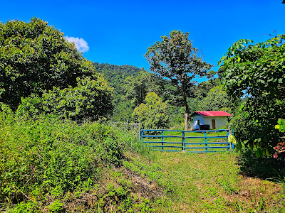 |
| To the left of this farm house is our escape route but not before we find our railways bridge And so, we persisted... |
 |
| ...this time, we were literally riding into a wall of shrubs, not knowing what lies ahead! |
 |
| But lo and behold, we were greatly rewarded with our persistence @ https://maps.app.goo.gl/4JNbtHoWUQ9wEPfU7 This railway bridge is about 7 km from LT D' Chalet |
 |
| Not everyone enjoys heights... |
 |
| ...but some are daredevils! |
 |
| It goes down a few more stories |
 |
| The waterfalls is not visible from this bridge but the stream flows beneath this bridge |
 |
| So, we returned to the farmhouse with blue gates and made our way out of the trail... |
 |
| Cross this bridge and you can already see Federal Route 1 ahead. View of Federal Route 1 and the trail we exited @ https://maps.app.goo.gl/XrWEFsqs62roVVfg7 |
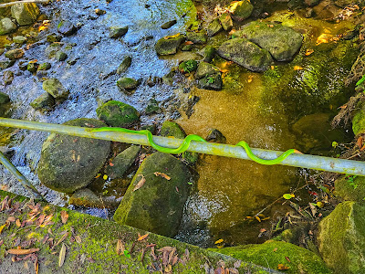 |
| Claudine almost leaned against this snake to capture a photo of her parked bike. She let out a blood curdling scream! |
 |
| Durian at Kampung Pauh @ RM10 per kg |
 |
| Right in front of a muslim cemetery |
 |
| Very lemak kampung durian |
 |
| Jalan Enam Kaki is really only 6 feet wide @ https://maps.app.goo.gl/ErM6YXtsC7tVfd7d9 |
 |
| Cooling down at Spritzer Eco Park |
 |
| Taking the overhead bridge across Jalan Air Kuning... |
 |
| ...to buy traditional biscuits from Biskut Tupai Mas @ https://maps.app.goo.gl/3GtKeB6pN1LGVULF8 |
 |
| A short stop at Taiping Lake Gardens before heading home |
 |
| We were lucky there was a trial run to make this section of the road car free! |
 |
| Bloodcount... |
 |
| Payment for passage across |


No comments:
Post a Comment