|
| Ulu Yam Waterfalls. Our ride began from Restoran Barakath Corner at 8 am and ended about 5.30 pm over a distance of 92 km |
 |
| After our breakfast of roti canai at Restoran Barakath Corner, we began the excruciating climb, circumventing Batu Dam. The climb was almost immediate, beginning from 99 Speedmart's Warehouse in Sungai Tua, Gombak and went on for almost 1.1 km with a gradehill of 8.5%. Unsure of the gradient, we were worried sick the entire climb to Batang Kali will be similar. Thankfully, we enjoyed a downhill glide to the dam thereafter followed by a long but gradual climb all the way to the peak. |
 |
| Glimpses of Batu Dam. There were bicycle parking facilities, concrete seats and walking paths all along the dam, all of which has since been abandoned, possibly after the area has been fenced up. However, we spotted many broken fences and anglers intruding into the dam |
 |
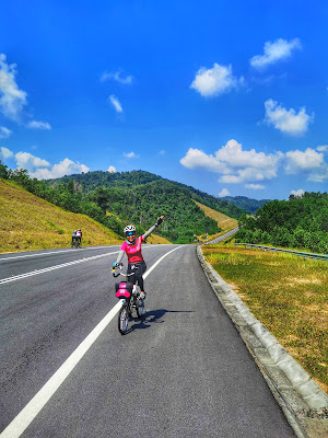
| While there were constant climbs, there were also descents. The challenge from Sungai Tua to the Peak spanned 12 km with average gradehill of 2.9% |
 |
| This area is spoilt for choice in terms of paid camping grounds. This stream runs past Nur Laman Bestari Eco Resort, Flinstone Chalet, Hutlista 1 and 2, a popular camping area |
 |
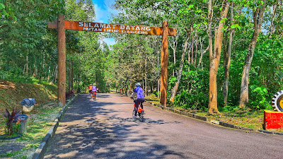
| Taman Eko Rimba Sungai Tua managed by Selangor's State Park shrouded in morning mist. |
 |
| Ulu Yam waterfalls at 9 am !!! At this point, we had only clocked 10 km ! |
 |
| While the route is very scenic and popular amongst cyclists, it is also a haunt for thrill seekers. Both 4 wheeled and 2 wheeled vehicles are often seen racing on this route which makes it dangerous for cyclists as the road comes with zero road shoulders. On the morning of our ride, we saw many sports car and big bikes congregating at Jalan Sungai Tua's Petronas. Later, a group of Porches and Lamborghini were revving up Ulu Yam, coming close and overtaking us at a hill slope! |
 |
| Not far from the peak where people come to collect spring water |
 |
| Note the zero road shoulders |
 |
| Emulating Audax riders resting by drains |
 |
| Kampung Sungai Chik's banana stop. |
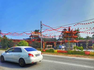 |
| Opposite our banana stop is a Chinese temple. Ulu Yam and Hulu Yam Baru's Route B57 is mostly Chinese populated. We were rolling past many similar temples with CNY decorations. |
 |
| Campsite at Air Terjun Sg Pinang |
 |
| Rosyabillah Chalet |
 |
| Easy path down to the river |
 |
| Air Terjun Sungai Pinang after the rain. |
 |
| There's no waterfalls despite the name |
 |
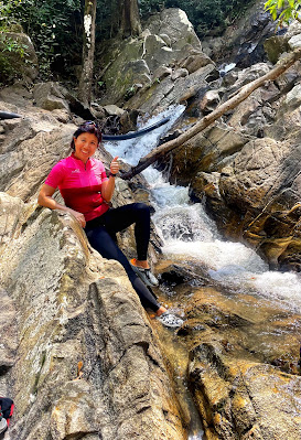
| Yours truly |
 |
| Basic chalets for rental, situated literally by the river banks. Each chalet has a name and different contact numbers, possibly individually owned |
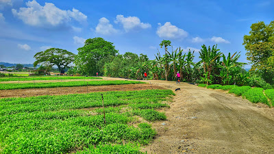 |
| After Sg Pinang, our next destination was Hulu Tamu Hot Springs. There were 2 routes to the hot springs. Our first attempt was via google walking route which turned out to be a gravel path. Our second attempt was via google driving route which took us to the junction to Hulu Tamu but we abandoned the destination for several reasons. Going in and out would have set us back 8.6 km plus it was too hot for hot springs at 11.30 am. Above photo, taken at 12.50 pm was after a long lunch at Restoran KH for fish head noodle and wat tan hor. |
 |
| Google walking route from Restoran KH to Serendah Waterfalls took us through farmyards. At the end of this road, the gate is locked. Chooi managed to get the farmer's hand to open the gate for us despite Mr Lim and VT's attempt to find a hole in the fence to carry 2 bikes over. |
 |
| Happy as we were, the short cut through Antara Gapi was fenced up and not passable anymore. We had to take the longer route via Route 1 |
 |
| The grey dotted line was our intended route. The circle was the entry into Antara Gapi which is already blocked. Had we been successful, we would have come to the Star point which is 7-Eleven. This 7-Eleven is by Route 1 which leads to Serendah. As it is, we had to return to point of origin and take the red line to Serendah instead! |
 |
| Route B57's Jalan Hulu Yam @ 1.30 pm |
 |
| Serendah Waterfalls @ 3 pm |
 |
| Cooling down by the stream |
 |
| There were several gazebos by the river |
 |
| Bridge across the shallow stream |
 |
| There were also paid toilet and shower facilities |
 |
| Day campers and picnickers. There was a booth renting tents as well. |
 |
| Perigi Tujuh or Telaga Tujuh or Seven Wells in Serendah is part of a dam system built by the British to mitigate floods in the area. Above are the 7 spillways which fed the 7 sluices not far away. As we had come during drier season, some of the spillways are not feeding water to the sluices. Also note the clogged spillways! |
 |
| The 7 sluices. Note the rough stone slabs and architecture used for construction are similar to many structures on Fraser's Hill. |
 |
| 2 gazebos built on top of the sluices for recreation purposes |
 |
| The overall landscape |
 |
| Rawang Bypass @ 4.30 pm |
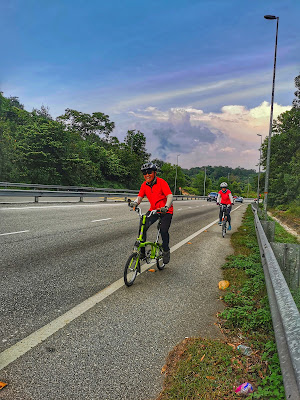 |
| Route 37 aka Rawang Bypass is a toll free road connecting Serendah to Selayang. The length of the bypass is 10.66 km. |
 |
| The actual climb which spans about 3.5 km starts from Serendah Interchange to Sunway Quarry's dirt road exit (known as Bukit Kuari). You climb from 31m to 191 m in height, so don't believe the gradehill spelt out on the signboard. |
 |
| The start of the 7 km descent |
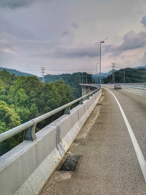 |
| Rawang Bypass - Second highest elevated bypass in Malaysia. The Electric pylons had to be built on a 2 storey concrete structure to ensure the power lines goes above the highway. At one point, we were as tall as the trees. Note the trees by the curve of the highway which resembles broccoli. These trees which are endemic to Peninsula Malaysia are known locally as Merawan Kanching with Hopea Subalata as its scientific name. According to FRIM, there are only 400 of this species left in the world and they can only be found in Kanching Forest in Rawang. The Rawang Bypass was built curvy, like a snake to reduce the environmental impact on this endangered species |
 |
| Up to 12 January 2022, Rawang Bypass at 58.2 m was the highest bypass in Malaysia. Bukit Kukus Bypass at 61.5 m opened to road users on 13 January, surpassing its predecessor. While Bukit Kukus Bypass comes with a bike lane, Rawang Bypass is a road to be ridden with extra caution. The bypass joins Route 1 which passes by Kanching Waterfalls and Templer's Park. Kanching Waterfalls was closed due to landslides when we were there. As we were rushing for time, we had to forgo Templer's Park as well. We exited Route 1 via Pesiaran Selayang Heights passing by Selayang's Magistrate Court, Land Office and Stadium. Thereafter, we took the inner roads passing by Taman Selayang Mutiara back to our cars. |
 |
| Our route @ 92 km |